


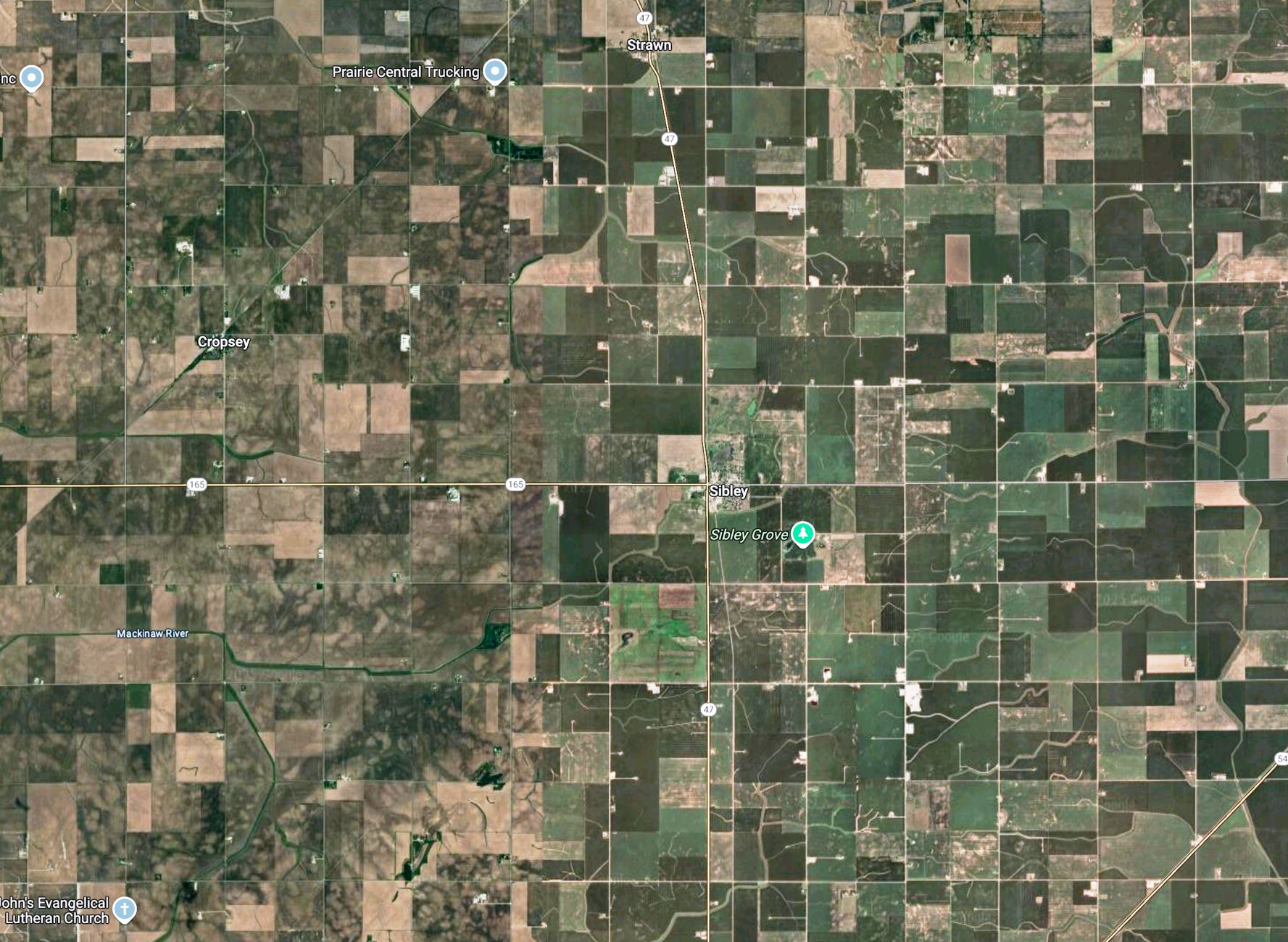
The naive, surface answer is: “Well, duh — agriculture. Like, farms, man.”
But I wanted to go a bit deeper!
Here’s what’s really going on behind that “checkerboard” landscape:
The squares came first, before most farmers ever saw the land.
After independence, Congress needed a quick, uniform way to survey tens of millions of frontier acres so it could sell them to raise cash. 🫰💵 💵 💵
So it passed the Land Ordinance of 1785, which created the Public Land Survey System (PLSS), a rigid grid of 6-mile-square “townships,” each split into thirty-six 1-mile-square sections (640 acres).
Section lines later became county roads, fence lines, and even school-district boundaries.
Because the division happened long before intensive settlement, later owners tended to keep those tidy squares rather than pay lawyers and surveyors to rearrange them.
Once the legal parcels were square, everything else followed. ⊞
If your deed is a neat square, it’s cheaper to build a straight fence and run a straight gravel road along the edge.
County engineers could lay out a whole road network by simply following section lines every mile. Rural electric and telephone co-ops strung wires down the exact same grid, and modern fiber optic lines now do too.
Deviating from the grid means negotiating easements with every neighbor, which is time-consuming and expensive, so most farms stick with the original shape.
Tidy geometry from a quill-made 1785 spreadsheet-equivalent is still shaping how broadband rolls out in 2025! 📜🪶
Path dependency!
🧭 This first appeared in Edition 570 of Liberty’s Highlights. New here? I made a page for that: Start Here.